Trending Now
- “If Edappadi Palaniswami permits, a thousand young members from the Virudhunagar district AIADMK are prepared to take up arms and engage in battle under my command.” – Former AIADMK Minister Rajendra Balaji
- “India is ready to deal with any counter-attack by Pakistan” – Wing Commander Vyomika Singh
- Central govt orders extension of CBI Director Praveen Sood’s tenure for another year
Coimbatore
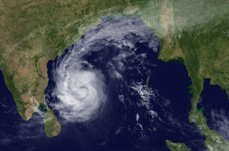
Cyclone Kyant prompts cautionary signals along state’s coast
![]() October 26, 2016
October 26, 2016
Chennai: Even as cyclone Kyant has put Andhra Pradesh and Odisha on high alert with the Met department predicting heavy rains and strong winds, cautionary signals have been raised at several ports in Tamil Nadu, including Chennai. Meanwhile, the weathermen said that the storm will continue to track westward, moving farther into the open Bay of Bengal towards eastern India.
It is expected that the rain will expand southward along the coast on Thursday. The worst conditions are predicted for Friday and Saturday as the storm approaches the coast between Visakhapatnam and Chennai. Locally damaging winds will be possible with gusts over 80 km/h (50 mph) within 120 km (75 mi) of where the storm makes landfall.
The storm may stall near the coast through the weekend as it weakens slowly and continues to unleash flooding rainfall near the coast of eastern India. The rain will be accompanied with high velocity winds gusting from 70-80 kmph. Sea conditions will also be rough and fishermen are advised not to venture into the sea along and off the coast.
TN coast on alert
In Tamil Nadu, cautionary signal No.3 has been hoisted at Chennai port and others, including Cuddalore, Nagapattinam and Kattupalli, while signal No.2 has been hoisted at Puducherry, Pamban, Ennore, Karaikal and Thoothukudi ports.
Meanwhile, the authorities in Chennai are gearing up for the impending monsoon by desilting storm water drains and water bodies.


